CUSTOMER STORIES

Transforming Grocery Delivery with Geospatial Insights
Instacart 2O24
Instacart 2O24
,
The Client
Instacart
Instacart is North America's leading grocery technology platform, connecting more than 1,500 retailers, 600,000 shoppers, and millions of customers. With delivery services reaching over 95% of households across the United States and Canada, Instacart is committed to creating a seamless and efficient grocery delivery experience.
The Challenge
Scaling retail coverage, delivery, and spatial analysis
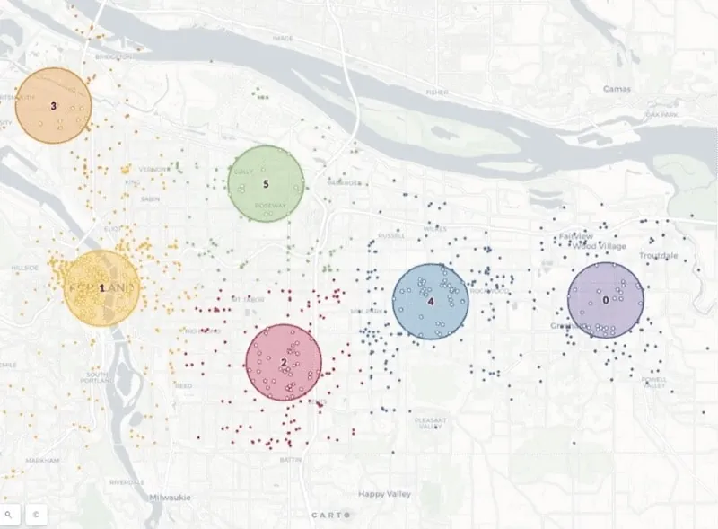
Operating at such a massive scale, Instacart experienced three main challenges. First, they needed to optimize retailer coverage to ensure that underserved areas, including food deserts, could access fresh groceries. Secondly, the company sought to improve delivery efficiency, requiring precise routing for their large network of shoppers while adapting to diverse city layouts. Thirdly, there was a need for scalable tools to analyze spatial variability in shopper and customer behavior, all while ensuring usability across teams with varying levels of geospatial expertise.
Results
Transforming operations with geospatial analytics
Using advanced geospatial analytics and data-driven approaches, Instacart improved its operations in different ways:
- They leveraged isochrones and integrated demographic data into retailer coverage analysis to improve access to fresh food for underserved communities.
- They enhanced delivery efficiency by optimizing routing and in-store navigation for over 600,000 shoppers, ensuring better service reliability.
- They enabled scalable insights and smart decision-making around retailer partnerships and customer satisfaction across 14,000 cities.
- They simplified geospatial visualization and strengthened engagement with internal stakeholders.
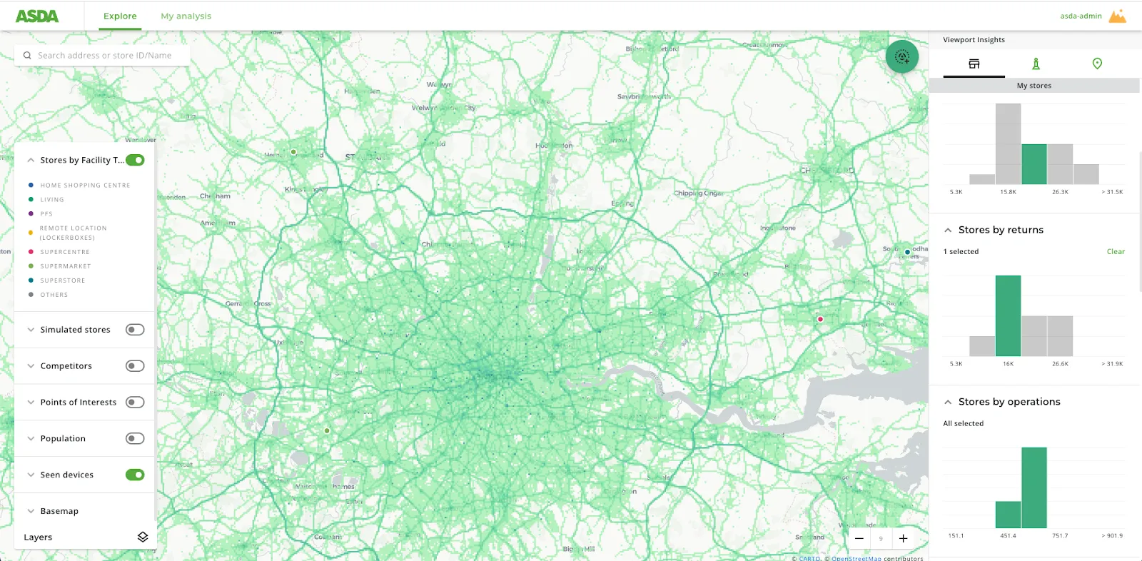
Why CARTO?
Enhancing accessibility to geospatial insights with CARTO
CARTO’s geospatial platform played a critical role in helping Instacart meet its challenges. By providing accessible solutions such as isochrones and demographic enrichment, CARTO enabled cross-functional collaboration without requiring significant custom development. This made geospatial insights more widely available and actionable across the organization.
+
.webp)
Transcription