Spatial Analytics

Spatial Analytics
CARTO Contributors CARTO Contributors ·

Using Spatial Analysis to Measure UK Gentrification

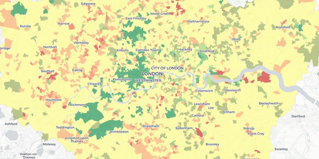
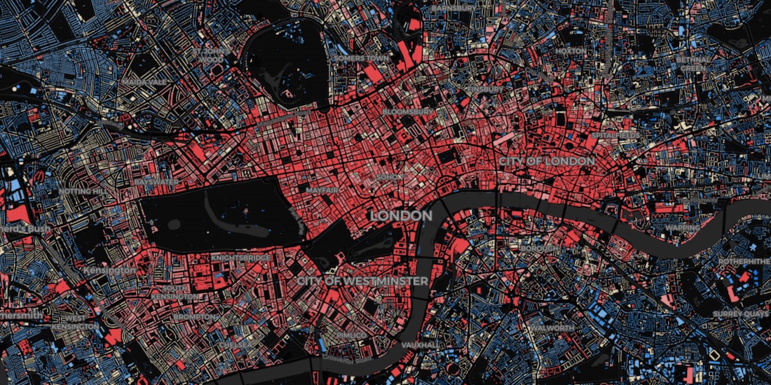
Read how Spatial Analysis & Machine Learning were used by researchers at UCL to understand neighborhood real estate changes & shape policy making in cities.

Spatial Analytics
Spatial Analytics
Dan Rushton Dan Rushton ·

London vs New York: Which city has the higher average building height?

The City vs Wall Street. Piccadilly Circus vs Times Square. The answer will surprise you as we discover through maps & visualization.

Spatial Analytics
Spatial Analytics
Florence Broderick Florence Broderick ·

Online Grocery Shopping - Route Optimization & Spatial Analysis during COVID19

How can online grocery shopping businesses use spatial analysis & route optimization to optimize through panic-buying? We explore real-life examples.

Spatial Analytics
Spatial Analytics
Matt Forrest Matt Forrest ·

Stop Using Zip Codes for Geospatial Analysis

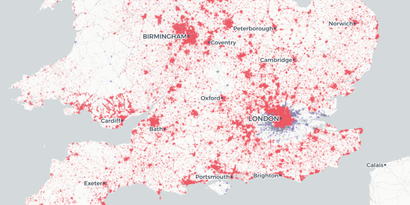
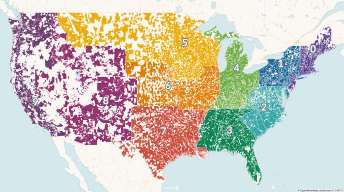
Uncover deeper insights beyond ZIP codes with geospatial analysis. Explore the limitations of ZIP codes and discover alternatives for spatial understanding.

Spatial Analytics
Spatial Analytics
CARTO Contributors CARTO Contributors ·

Mapping Geoawesomeness' Top 100 Companies and Startups

Our team used CARTO VL and Airship to map the Geoawesomeness Top 100 Geospatial Companies and Startups list

Spatial Analytics
Spatial Analytics
CARTO Contributors CARTO Contributors ·

Mastering layers in CARTO Builder

Spatial Analytics
Spatial Analytics
CARTO Contributors CARTO Contributors ·

Creating Animated Maps with CARTO Builder

Explore the power of Torque.js, offering innovative geospatial data aggregation for both time and space. Animate and analyze data trends effortlessly!

Spatial Analytics
Spatial Analytics
CARTO Contributors CARTO Contributors ·

Styling with Turbo Carto

Spatial Analytics