


Home
Geospatial Learning Across the Curriculum at NYU
NYU collaborates with CARTO to enhance GIS learning, enabling students to utilize location intelligence across disciplines.

CARTO strengthens its Sales team, adding key individuals!

Styling with Turbo Carto
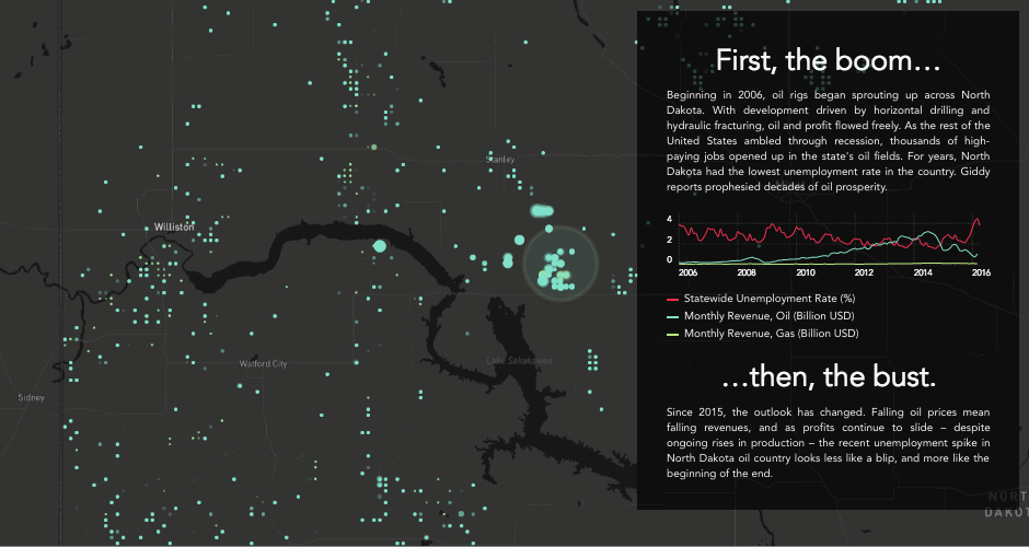
Boom or Bust! What Enigma’s newest project tells us about the economy of North Dakota
Explore Enigma's Boom or Bust project, delving into North Dakota's economy using CARTO for compelling visual storytelling.
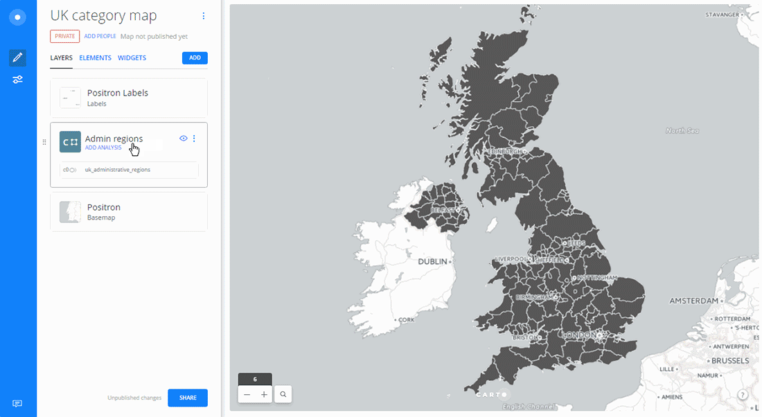
Creating Category Maps with CARTO Builder
Learn to create Data-Driven Maps with CARTO Builder! Color-code geospatial features by category effortlessly. Improve decision-making now!
CartoDB to CARTO: the Back Story to our New Brand
Discover the rebranding of CartoDB into CARTO, a cloud-native platform enhancing location intelligence and spatial data analysis capabilities.
Connect and learn with CARTO in September
Explore groundbreaking spatial analysis & visualization innovations by CARTO. Join us at events worldwide & dive into data insights. Discover more!

Better Aggregation Methods for Exploring Big Datasets
