


CARTO's Data Observatory 2.0, now powered by Google BigQuery
By working with Google BigQuery, the Data Observatory is transforming into the most cost effective and advanced spatial data infrastructure.
By working with Google BigQuery, the Data Observatory is transforming into the most cost effective and advanced spatial data infrastructure.

We’re introducing Data Observatory 2.0, the latest version of our spatial data repository that will make spatial data more accessible and faster to manipulate for Data Scientists and Analysts across the globe.
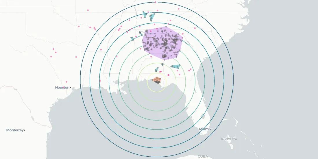
Aggregated visit pattern data, like SafeGraph's, has implications for investment decision making, public health, environmental efforts, and more

The Spatial Data Science Conference 2019 brings together leaders from industry, government, and academia for a day of panels and discussions on the latest technologies and techniques.
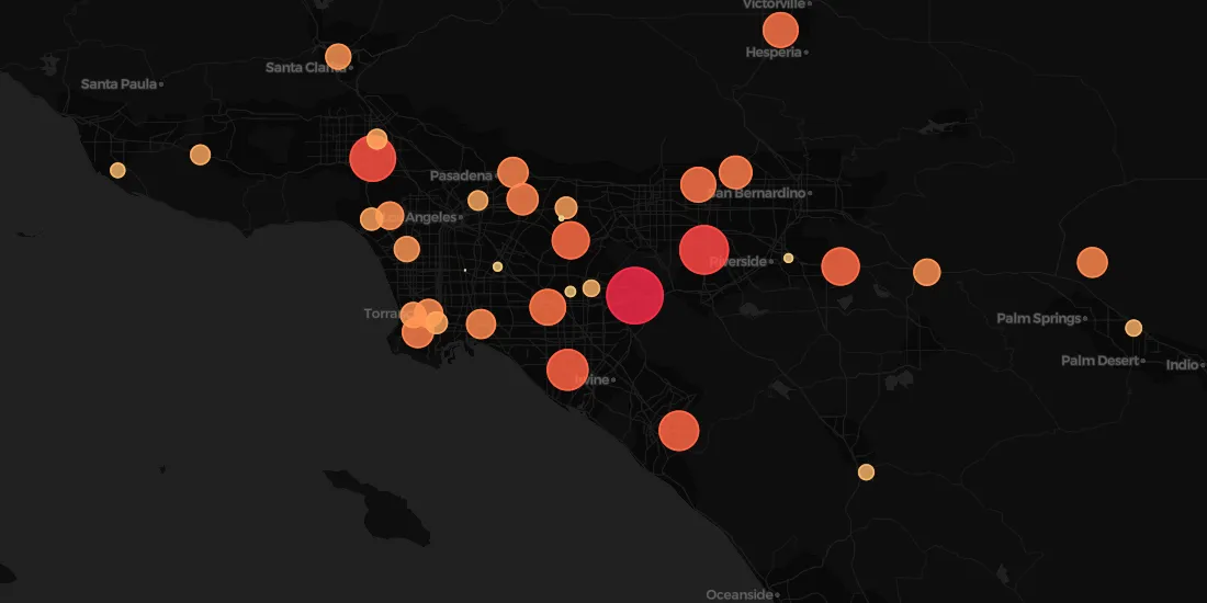
Predicting store revenues is critical, allowing retail leaders to stay agile, make informed decisions around current store operations, and plan the most effective new openings. The most accurate prediction models include the location component.

Federated tables allow CARTO users to combine data hosted in CARTO with data that lives in a remote database such as Amazon Aurora and Microsoft Azure
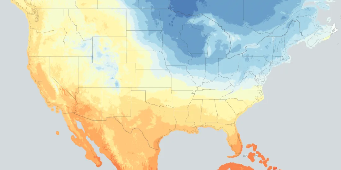
From meeting fluctuating customer demands and scheduling services, to proactively optimizing workflows to minimize risks in case of extreme events, weather-related data represents a huge asset
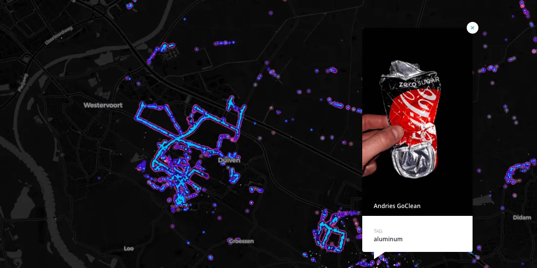
Learn how Litterati is leveraging Location Intelligence and Spatial Data Science in the fight against global litter

In order to achieve our plan of being the leading location intelligence platform, we continually invest in our infrastructure to provide the best service to our client. Today we are telling a success story about how we revamped our configuration management system
Announcing the inclusion of premium datasets from Applied Geographic Solutions (AGS) in our Location Data Stream Catalogue