


COVID-19 Inequality: A Focus on Brazil Coronavirus Maps
With Brazil Coronavirus cases soaring we take a look at the importance of using maps as an awareness tool to ensure an appropriate response.
With Brazil Coronavirus cases soaring we take a look at the importance of using maps as an awareness tool to ensure an appropriate response.
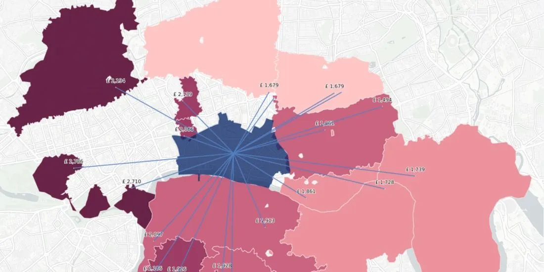
We explore Howsy's research on walk to work rental hotspots across London, with consumers looking to ditch mass transit as they look to change their new normal commute.
Using data from the COVID Racial Data Tracker we calculate the mortality risk from COVID-19 for Black Americans & visualize the results.
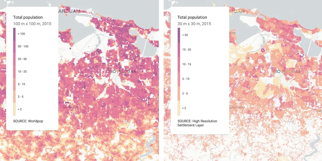
WorldPop global demographic data is now available in our Data Observatory for spatial analysis at fine spatial resolution.

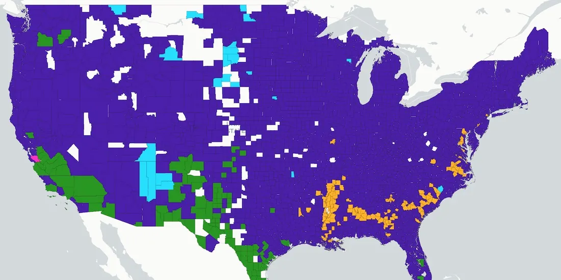
Using Spatial Analysis to analyze & visualize Location Data relating to the recent protests & police violence in the US including a protest map.

To enable safe social distancing cities are pedestrianizing urban areas & building infrastructure for greener transportation & micromobility. Discover how location data can help.

Read how Spatial Analysis & Machine Learning were used by researchers at UCL to understand neighborhood real estate changes & shape policy making in cities.
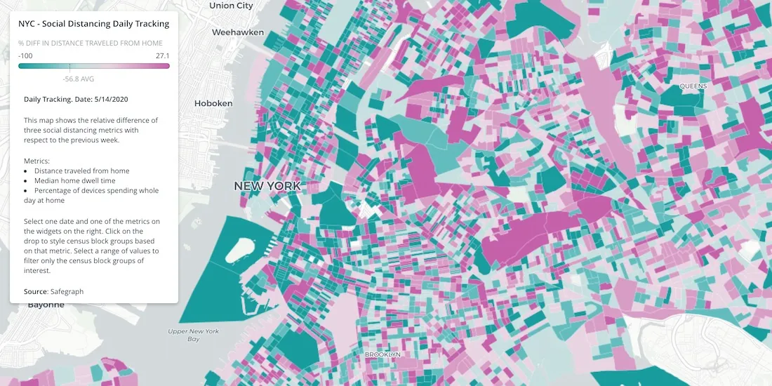
Location Data Streams from Apple, Unacast, Safegraph, & others now available for Spatial Analysis in our Data Observatory to aid in post COVID-19 recovery.
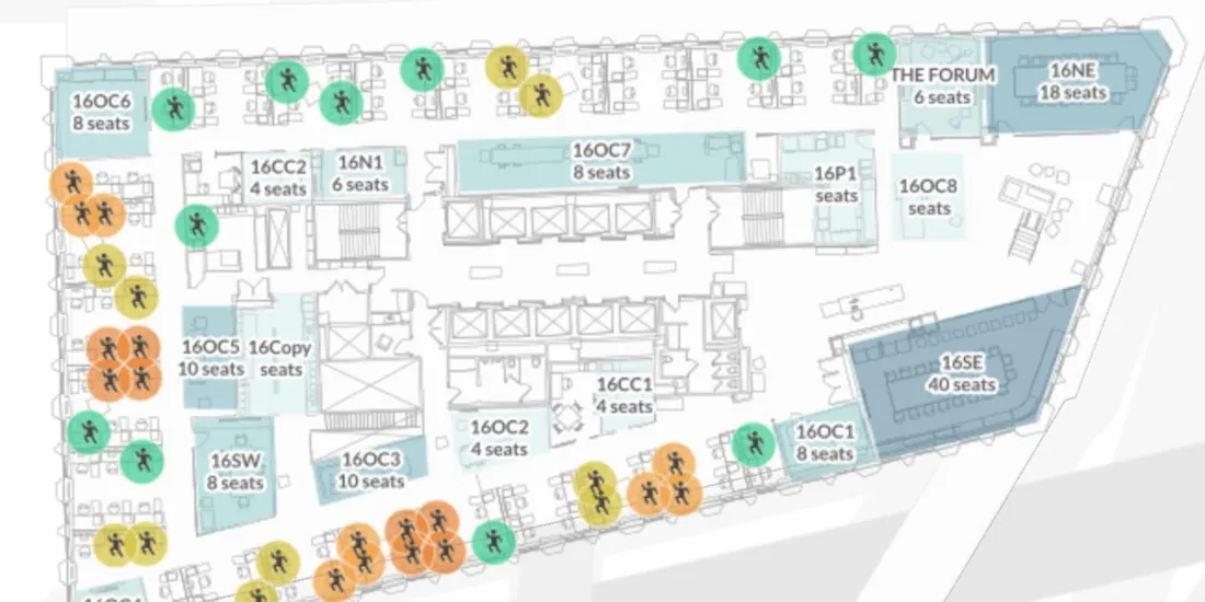
We explore how GIS Indoor Mapping Software can help organizations on their return to work, ensuring best practice in social distancing & contact tracing.
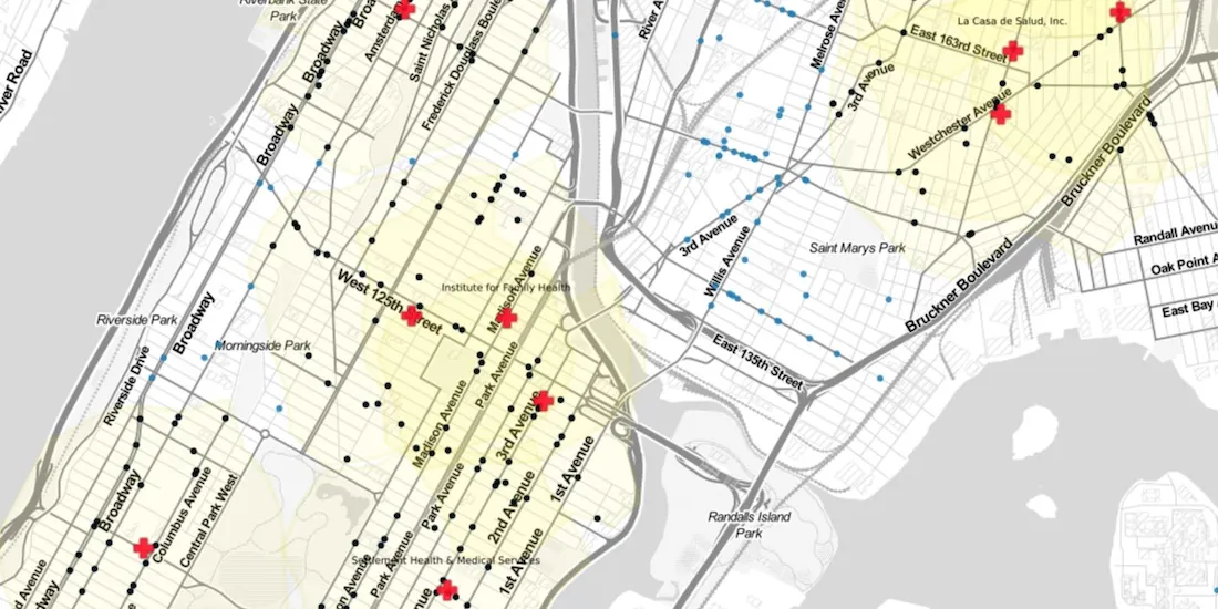
Read how HIPAA compliance is maintained across the CARTO platform & about key use cases for customers working in the healthcare space.