


Predicting Traffic Accident Hotspots with Spatial Data Science
Road traffic injuries are a leading cause of death & have a big economic effect. Read how Spatial Data Science can identify dynamic hotspots & reduce accidents.
Road traffic injuries are a leading cause of death & have a big economic effect. Read how Spatial Data Science can identify dynamic hotspots & reduce accidents.

We are pleased to announce our partnership with Lifesight, a leader in human mobility, & the inclusion of their data in our Data Observatory

With COVID-19 vaccines requiring strict storage, ensuring an efficient cold chain transportation network using spatial will be key for effective distribution
Discover how CPG/FMCG marketers & CMOs can use geospatial analysis & data to evolve their analytics to rapid consumer changes in the new normal

We are pleased to announce our partnership with Transparent, a leader in short-term rental intelligence, & the inclusion of their data in our Data Observatory

With COVID-19 causing dramatic shifts in consumer spending behavior, DIY & other retailers can leverage geospatial data to discover new revenue opportunities.
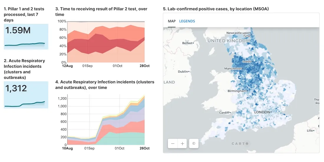
As cases of Coronavirus rebound, having an effective Test & Trace system in place is crucial. A new dashboard with maps evaluates the NHS response in England.
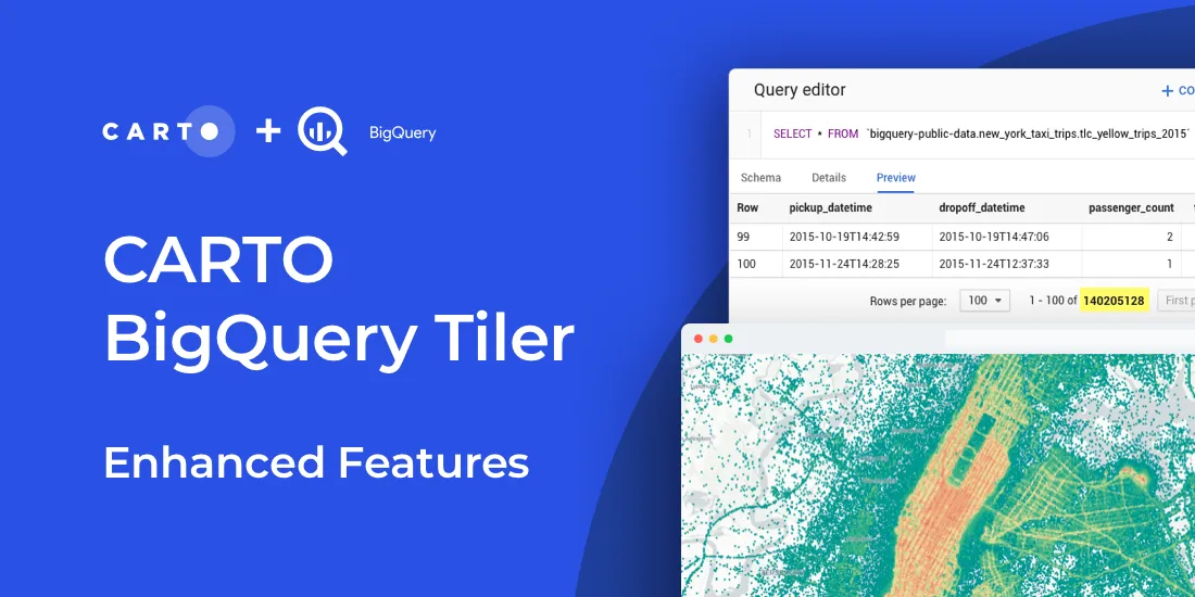
Read about new features to CARTO BigQuery Tiler: the fastest, most convenient, & cost effective way to visualize spatial Big Data & generate Tilesets for the web
Modern Distribution Management, encompassing supply chain network design & logistics optimization, is going through a transformation. See why spatial is key.

As #SDSC20 draws to a close today, we reflect on the conference & announce the first winner of the Spatial Data Scientist of the Year Award!