Blogs
Use cases

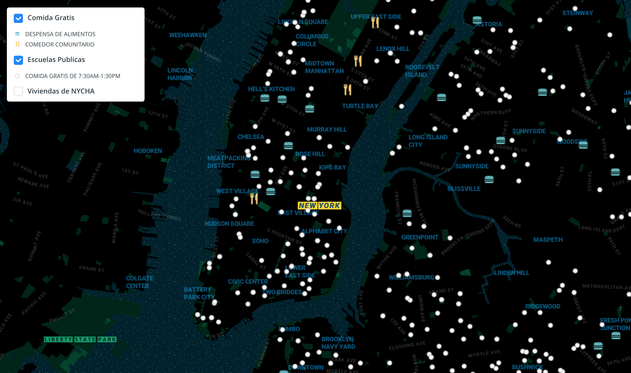
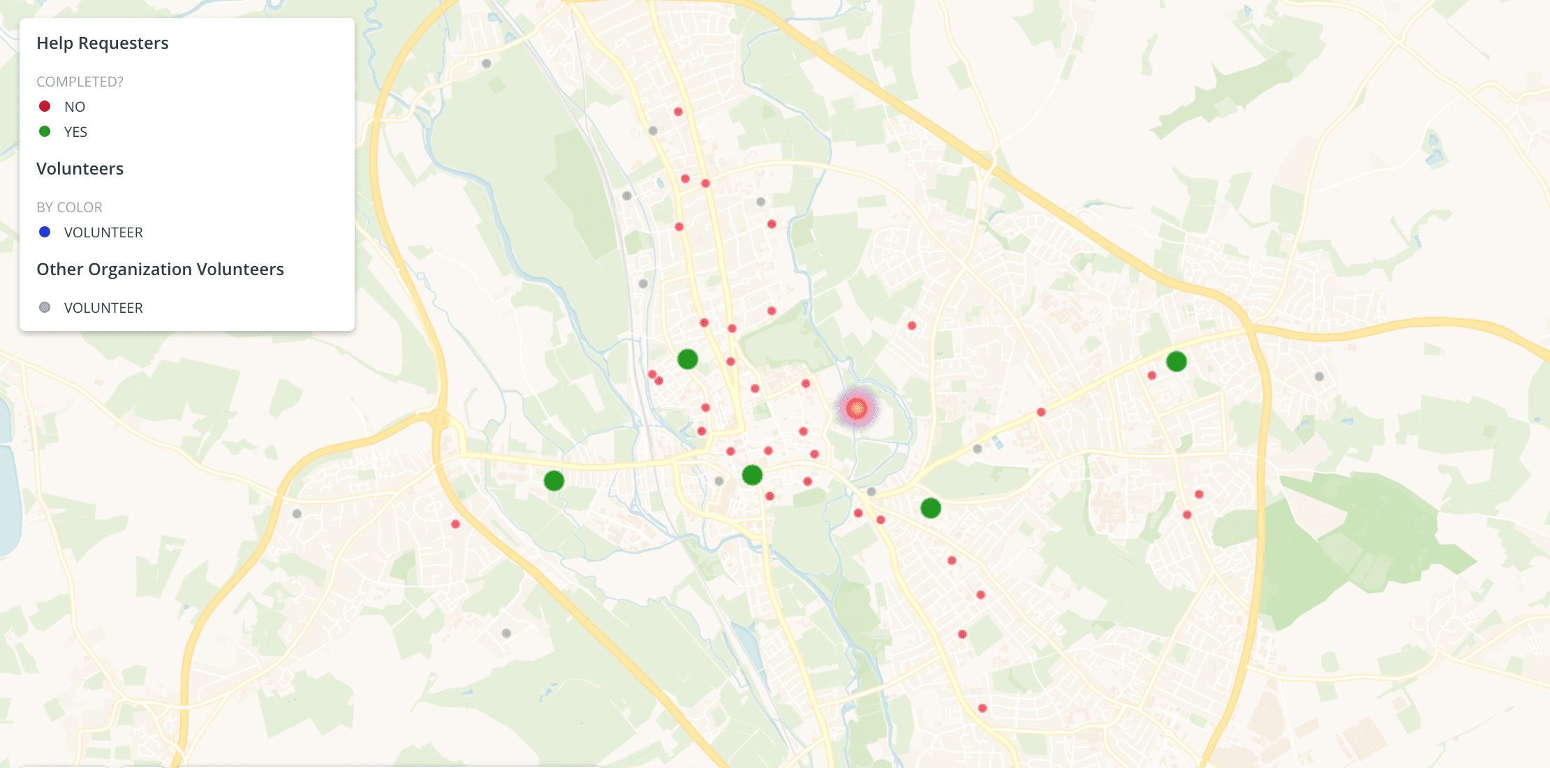
Analyzing Food Access in NYC During COVID-19

We explore how Territorial Empathy are using spatial analysis to visualize food access across NYC during the pandemic.

CARTO ·
Blogs
Spatial Analytics

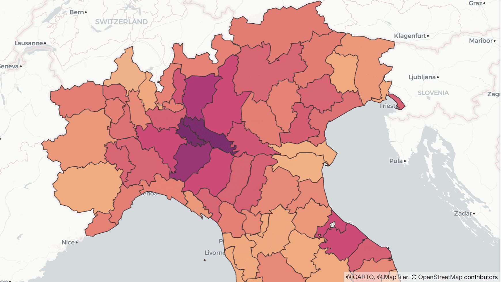
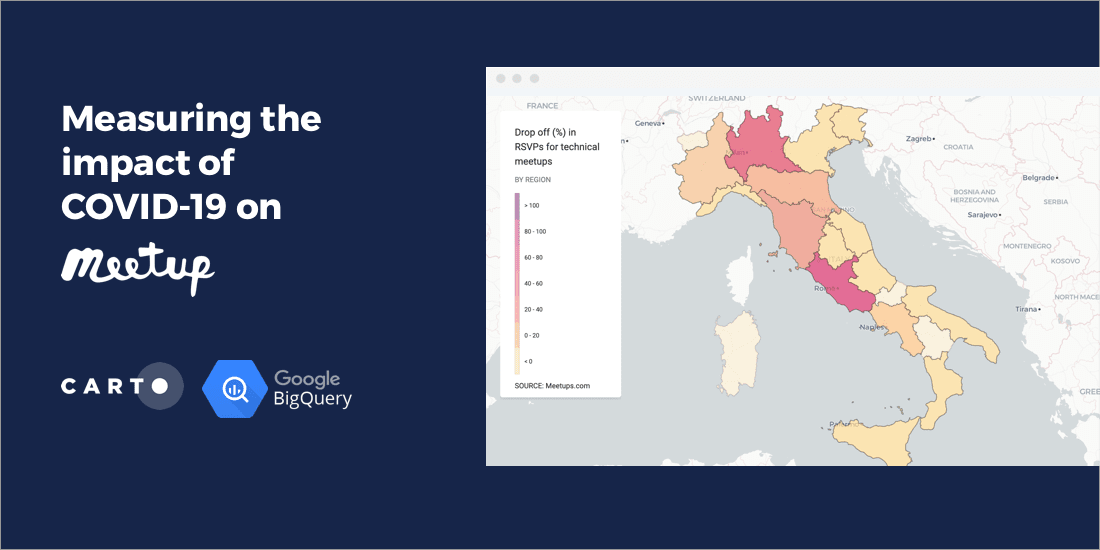
Online Grocery Shopping - Route Optimization & Spatial Analysis during COVID19

How can online grocery shopping businesses use spatial analysis & route optimization to optimize through panic-buying? We explore real-life examples.

CARTO ·
Blogs
Use cases

Mobilizing Volunteers to Help the Most Vulnerable through Maps

#StudentsAgainstCorona is a platform supported by our grants program enabling the pairing of volunteers with the elderly & vulnerable individuals who need support through the Coronavirus lockdown.

CARTO ·
Blogs
Use cases

Why Lockdown Matters: Exploring Human Mobility Data in Italy

Analyzing the relationship between human mobility and the spread of COVID-19 in Italy.

CARTO ·
Blogs
App Development

CARTO collaborates on 'AsistenciaCovid19' App against Coronavirus

CARTO work alongside ForceManager, Mendesaltaren, Telefonica, Google, Ferrovial & others to slow down the spread of COVID-19

CARTO ·
Blogs
Cloud Native

Analyzing the Impact of Coronavirus on Meetups

A look at the impact of Coronavirus on Meetup RSVPs including the correlation between the location of COVID-19 cases and attendance in Italy

CARTO ·
Blogs
Cloud Native

CARTO + Kepler.gl: Two Tools, One Workflow

Kepler.gl and CARTO users can now work seamlessly across both tools. Our integration adds a new cloud storage feature to Kepler.gl, allowing users to share and save maps privately using CARTO.

CARTO ·
Blogs
Cartography & Visualization

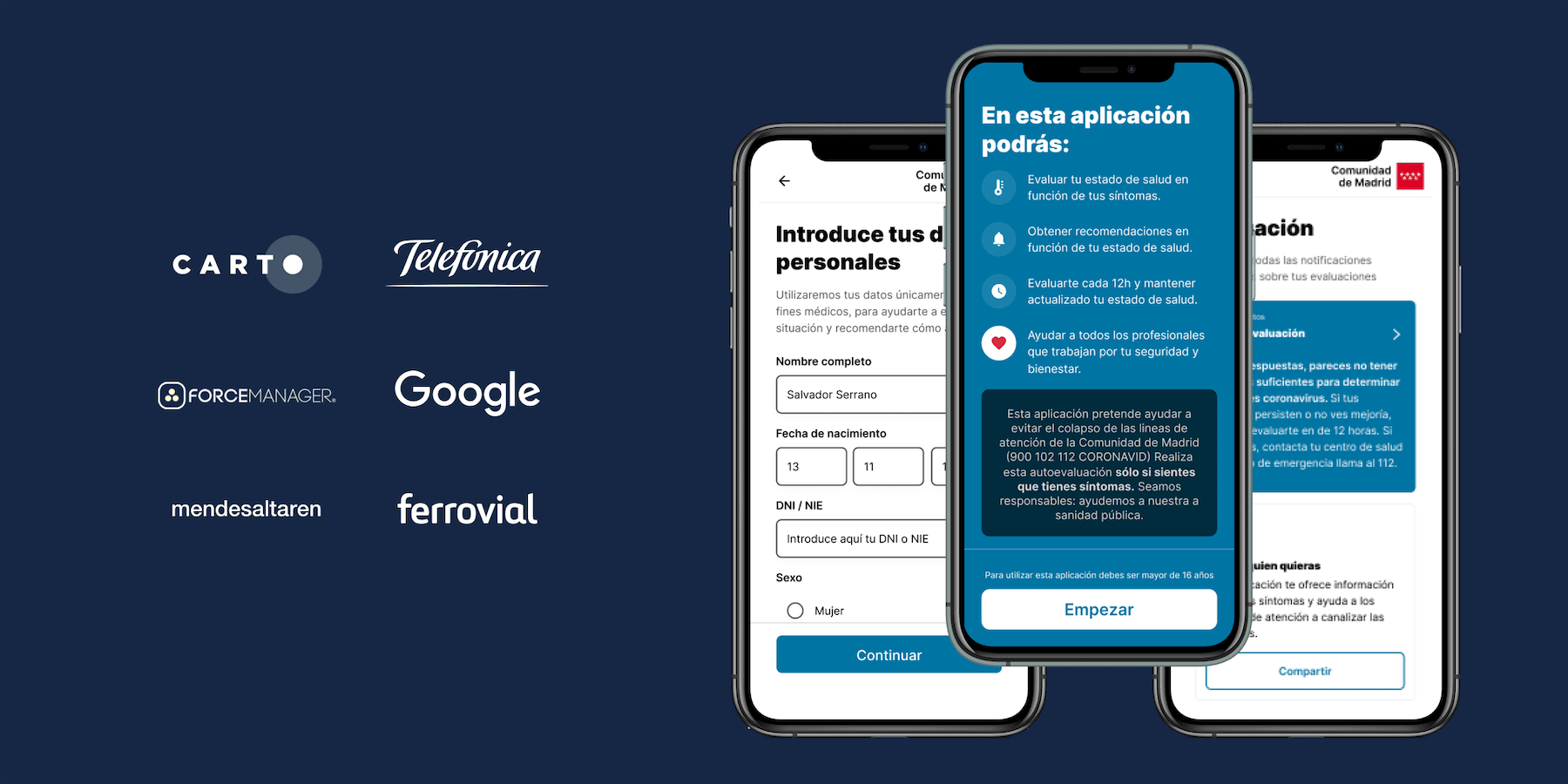
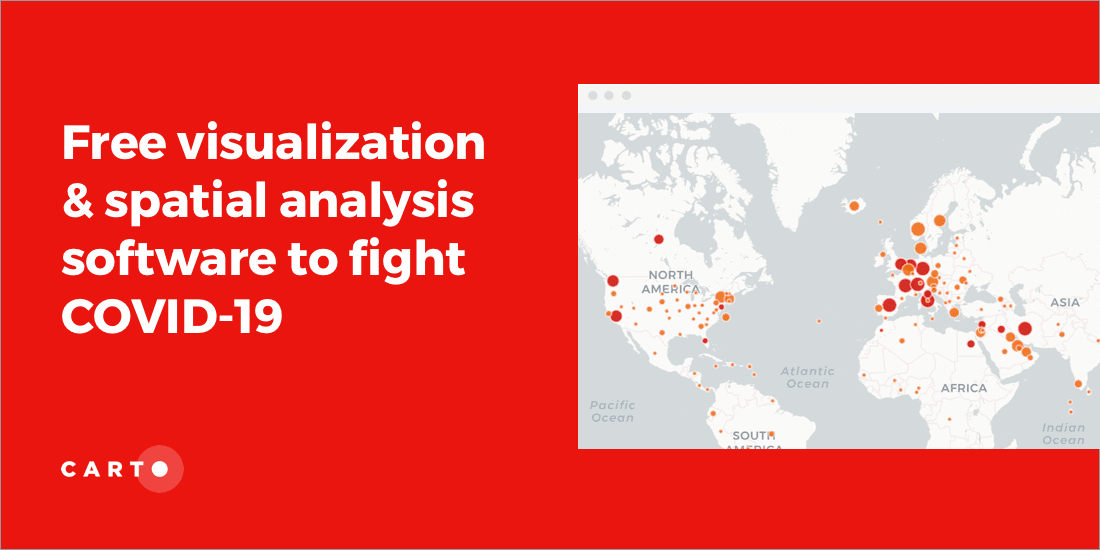
CARTO Provides Free Visualization Software for Organizations Fighting COVID-19

The CARTO Grants for Good program gives organizations fighting COVID-19 access to our platform for mapping & visualization of the outbreak

CARTO ·
Blogs
Cartography & Visualization

Mapping Coronavirus Impact on Events & Conferences

A look at the effect that Coronavirus (COVID-19) is having on tech events and conferences around the world

CARTO ·
Blogs
Spatial Data

Doorda in CARTO: UK Demographics, Socio-economic Data, and More

Trusted, business-ready data for the UK is now available in CARTO through our partnership with Doorda. These datasets will reduce data cleaning and prep time and allow you to get straight to analysis.

CARTO ·