Blogs
Core Tech

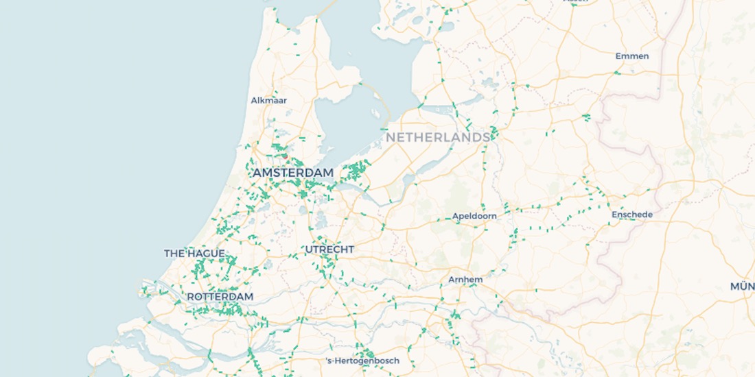
10,000 Dutch Bridges: A Foray into Using BigQuery Connector

Explore how to use our Google BigQuery connector to import large public datasets for geospatial analysis.

CARTO ·
Blogs
Use cases

Acquiring New Customers with Geomarketing for Online Retailers

Learn more about Geometric, a Geomarketing solution for Online Retailers made by Anagraph & their work creating COVID-19 dashboards for Canada.

CARTO ·
Blogs
Use cases

Assessing Potential Impact of COVID-19 on Rural Communities

Read how the Center on Rural Innovation & others used CARTO to determine which rural communities in the US are in need of greater support against COVID-19.

CARTO ·
Blogs
Use cases

OOH Bounce Back: 2020 Predictions

A look at the impact of COVID-19 on OOH & how geospatial solutions can be used in the post pandemic recovery of the industry.

CARTO ·
Blogs
Spatial Data

Open Data on COVID-19 Now Available in Data Observatory

CARTO makes available a set of COVID-19 related datasets as public data in the Data Observatory v2.0

CARTO ·
Blogs
App Development

CARTO & Fulcrum partner to provide COVID-19 emergency response solutions

Leaders in data collection & spatial analysis come together to enable organizations to overcome the coronavirus through grants program.

CARTO ·
Blogs
Spatial Data

Spatial.ai in CARTO: Geosocial Data Insights During & Post COVID-19

Geosocial Data is now available in CARTO through our partnership with Spatial.ai. See how location-based social media data can be used in spatial analysis.

CARTO ·
Blogs
Use cases

Location Analytics: A Roadmap to Post COVID-19

Everyone has the same question: when will we return to normal? Spatial analysis has helped immensely to contain the spread, now how will it help us recover?

CARTO ·
Blogs
App Development

AsistenciaCOVID-19 Available in Five New Regions of Spain

AsistenciaCOVID-19, the self diagnosis app which CARTO is collaborating on, is now available in five new regions of Spain.

CARTO ·
Blogs
Spatial Data Science

How Location Data Streams Can Be Used to Fight Against COVID-19

A look at how spatial data & analytics can become insightful resources to those designing, monitoring & optimizing responses against COVID-19.

CARTO ·