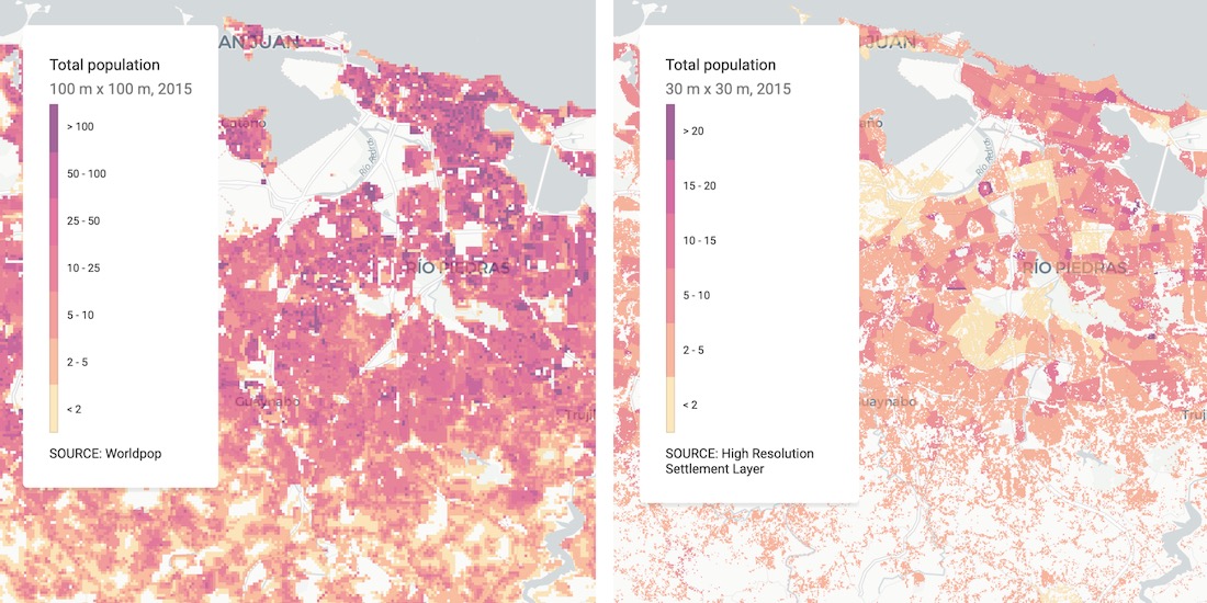
Blogs
Spatial Data

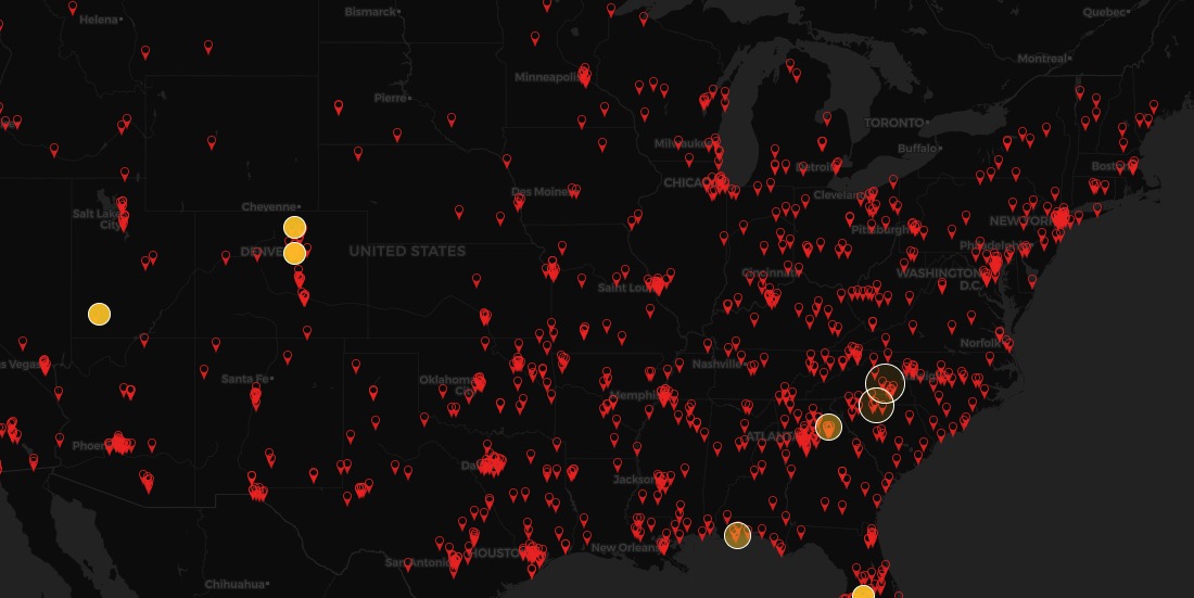
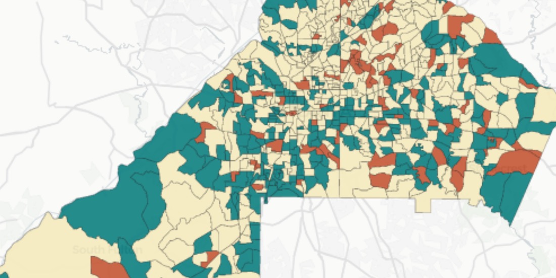
COVID-19 Inequality in the US: How Coronavirus is killing more Black Americans

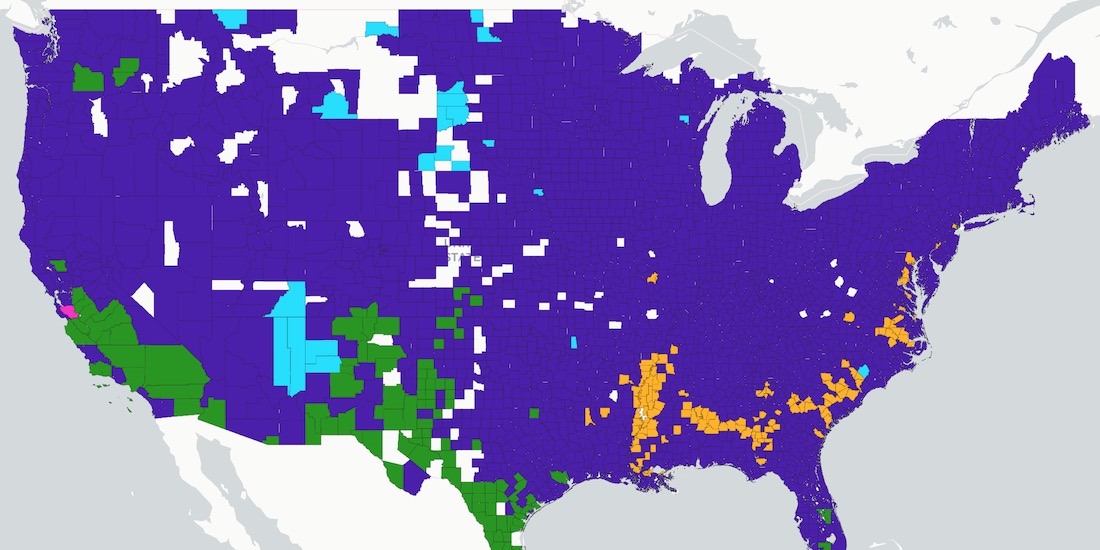
Using data from the COVID Racial Data Tracker we calculate the mortality risk from COVID-19 for Black Americans & visualize the results.

CARTO ·
Blogs
Spatial Data

WorldPop in CARTO: global demographic insights at high granularity

WorldPop global demographic data is now available in our Data Observatory for spatial analysis at fine spatial resolution.

CARTO ·
Blogs
Use cases

US Protest Map & Visualizing Police Violence

Using Spatial Analysis to analyze & visualize Location Data relating to the recent protests & police violence in the US including a protest map.

CARTO ·
Blogs
Use cases

City Pedestrianization & Micromobility Post COVID-19

To enable safe social distancing cities are pedestrianizing urban areas & building infrastructure for greener transportation & micromobility. Discover how location data can help.

CARTO ·
Blogs
Spatial Analytics

Using Spatial Analysis to Measure UK Gentrification

Read how Spatial Analysis & Machine Learning were used by researchers at UCL to understand neighborhood real estate changes & shape policy making in cities.

CARTO ·
Blogs
Spatial Data

New Location Data Available for COVID-19 Recovery Analysis

Location Data Streams from Apple, Unacast, Safegraph, & others now available for Spatial Analysis in our Data Observatory to aid in post COVID-19 recovery.

CARTO ·
Blogs
Use cases

GIS Indoor Mapping: Workplace Social Distancing

We explore how GIS Indoor Mapping Software can help organizations on their return to work, ensuring best practice in social distancing & contact tracing.

CARTO ·
Blogs
Use cases

HIPAA Compliance in Geospatial Healthcare Analytics

Read how HIPAA compliance is maintained across the CARTO platform & about key use cases for customers working in the healthcare space.

CARTO ·
Blogs
Spatial Analytics

London vs New York: Which city has the higher average building height?

The City vs Wall Street. Piccadilly Circus vs Times Square. The answer will surprise you as we discover through maps & visualization.

CARTO ·
Blogs
Use cases

Using Spatial Data in Retail Analytics Post COVID-19

A look at how spatial analysis & new data streams such as telco & credit card data can provide insights in a return to retail post COVID-19.

CARTO ·