Blogs
Spatial Data

How to retrieve spatial data from APIs, the no code way

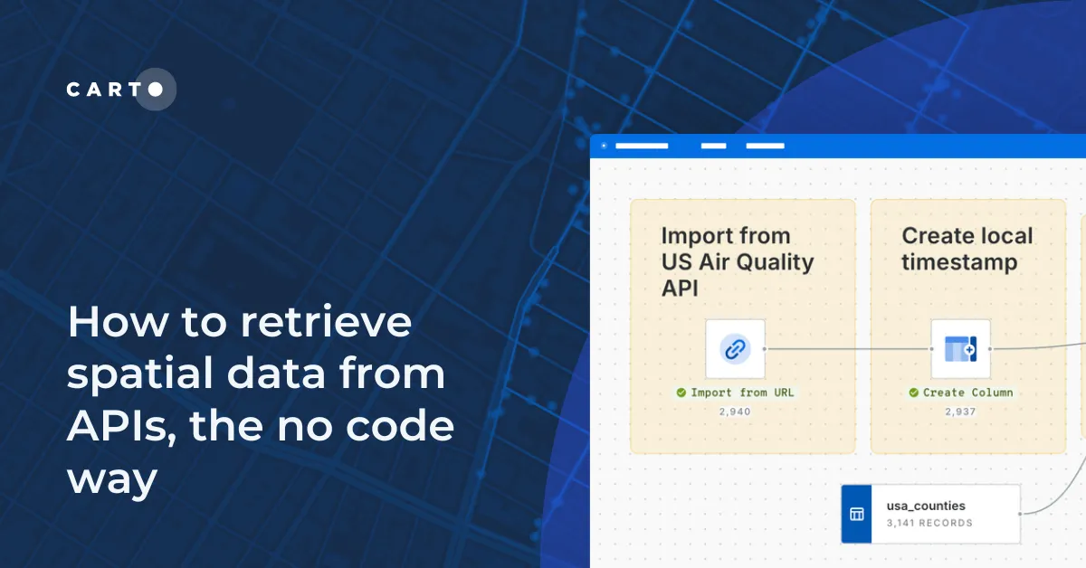
Learn how to retrieve spatial data from APIs without coding! Discover the benefits of using REST APIs for scalable and automated geospatial analysis.

CARTO ·
Blogs
Use cases

Cloud-native Life Sciences analytics with CARTO & Snowflake

Optimize Life Sciences analytics with cloud-native geospatial solutions using CARTO & Snowflake. Scale data insights for improved decision-making.

CARTO ·
Blogs
Use cases

What is Supply Chain Network Design and How Does It Work?

Improve your supply chain network design! Use spatial analysis to optimize your supply chain design for cost savings, efficiency, resilience & sustainability.

CARTO ·
Blogs
Spatial Data

Boost Telecom Analysis with FCC Data - now available on CARTO!

Access FCC telecom data on CARTO for seamless, cloud-native insights! Analyze broadband & mobile availability, speeds, and more for the entire U.S.

CARTO ·
Blogs
Spatial Data

4 Key Points on Raster Analytics from CARTO & Snowflake

Discover how cloud-based raster analytics with CARTO & Snowflake streamlines large dataset management and enhances spatial analysis. 

CARTO ·
Blogs
Spatial Analytics

New to CARTO? Try these 5 things first!

New to CARTO? Discover the first 5 things to try, from running a cloud-native spatial analysis to creating your first map.

CARTO ·
Blogs
Cloud Native

What being “cloud-native” should really mean for your spatial data

What does it mean to be truly cloud-native? Enhance security, eliminate data silos & redundancy, and revolutionize your geospatial workflows with CARTO.

CARTO ·
Blogs
News

The State of Spatial Data Science 2024 - get your free copy!

Download your FREE copy of The State of Spatial Data Science 2024; stay ahead with insights on AI, cloud integration, GIS, climate impact & more!

CARTO ·
Blogs
News

What's New in CARTO - Q2 2024

Explore the latest CARTO platform features unveiled in Q2 2024! Working with external APIs, raster data, the new developer space - and more!

CARTO ·
Blogs
Cartography & Visualization

Introducing CARTO Heatmaps for Big Data Visualization

Enhance your big data visualization with CARTO's heatmap style! Learn how to impactful, large-scale heatmaps with this guide.

CARTO ·