Balancing Territories for Equity and Efficiency: A Field Sales Data Study
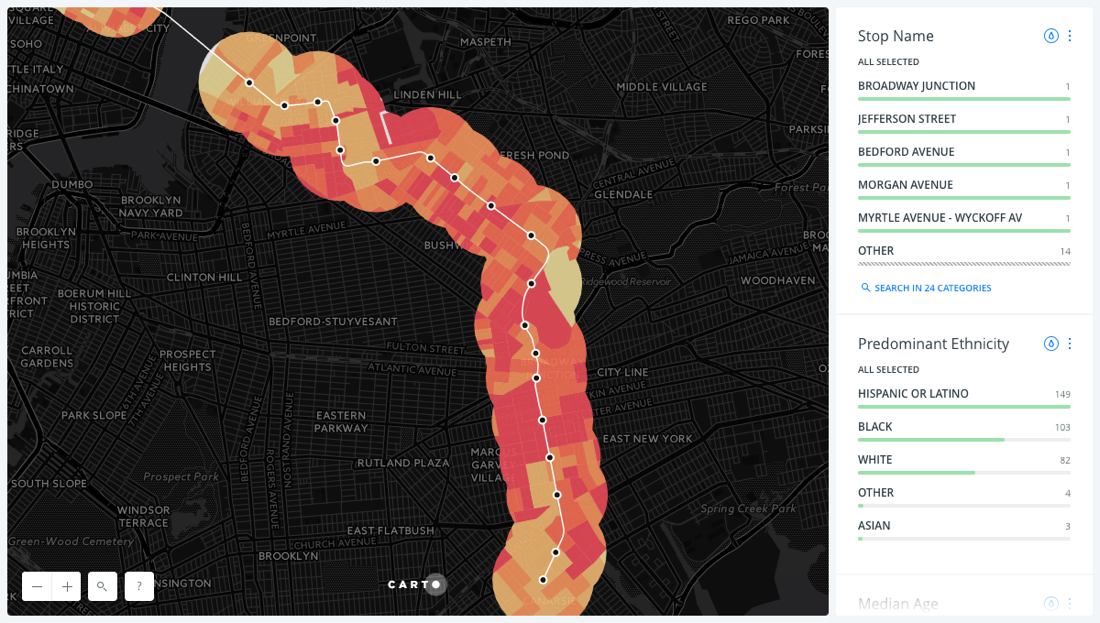
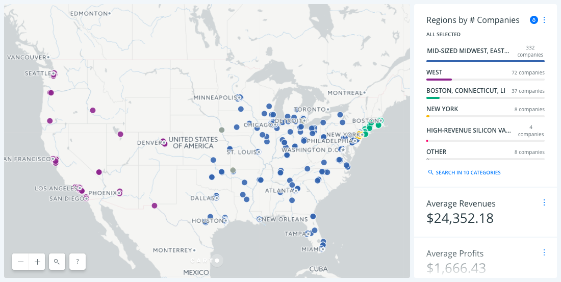
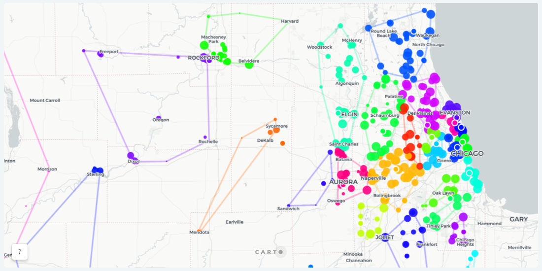
Spatial analytics and data science can help sales managers to eliminate guesswork and create well-reasoned and data-driven territories

Announcing Open Source Tools Connecting CARTO and Waze
New Open Source Tools are Enabling Smart Cities to Collect, Visualize, and Analyze Waze Traffic Data

Announcing Microsoft & CARTO Strategic Partnership
Today Microsoft and CARTO announce their strategic partnership, focused to bring cutting-edge Location Intelligence solutions to the enterprise world.

An update on MVT encoders
Explore enhanced MVT encoding performance with Postgis' St_AsMVT technology, optimizing resources and minimizing network load for efficient vector tile generation.

Airship: A New Front-End Library for Location Intelligence Apps
With Airship, designers and developers can generate styles, interactive elements, typography, and many more design elements optimized specifically for location applications

Aggregating data for faster map tiles
Map tiles can be speedup for larga data sets by using aggregation

A SQL approach to graph coloring applied to maps
How to solve the graph coloring problem implementing several map coloring algorithms in PostGIS

A Really Good Guide on Location Intelligence Implementation
Follow this step-by-step Location Intelligence guide to turn your location data into business outcomes.

A new look for Positron and Dark Matter basemaps
Positron and Dark Matter have been redesigned with their original purpose in mind.

A Better Approach to Sales Territory Management Using Spatial Clustering
Using a spatially constrained clustering analysis, we show you how sales teams can think differently about their sales territories.

