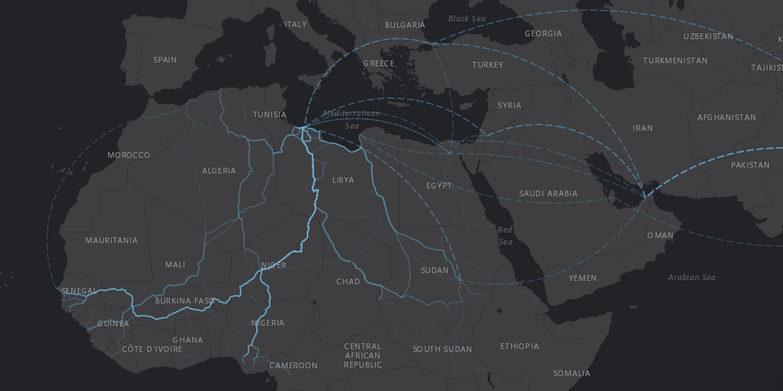
Map of the Month: World Refugee Day
Solutions to the challenges faced by refugees, displaced persons, and the world as a whole as it tries to assist them are rooted in location data

Map of the Month: Where Are All The New Houses
Exploring the insights drawn from visualizing a decade of housing and real estate development via open data in England

Map of the Month: Seattle Poetic Grid
Learn how our Location Intelligence platform helped execute the vision of Seattle’s Civic Poet Claudia Luna Castro in our latest Map of the Month post.

Map of the Month: Reach of CJ Marple’s Tweet

Map of the Month: Pi Project - Connecting the World Through Art

Map of the Month: Landmine Removal in Nagorno-Karabakh
HALO, together with its donors, has been clearing landmines and unexploded ordnance (UXO) in Nagorno-Karabakh since 2000.

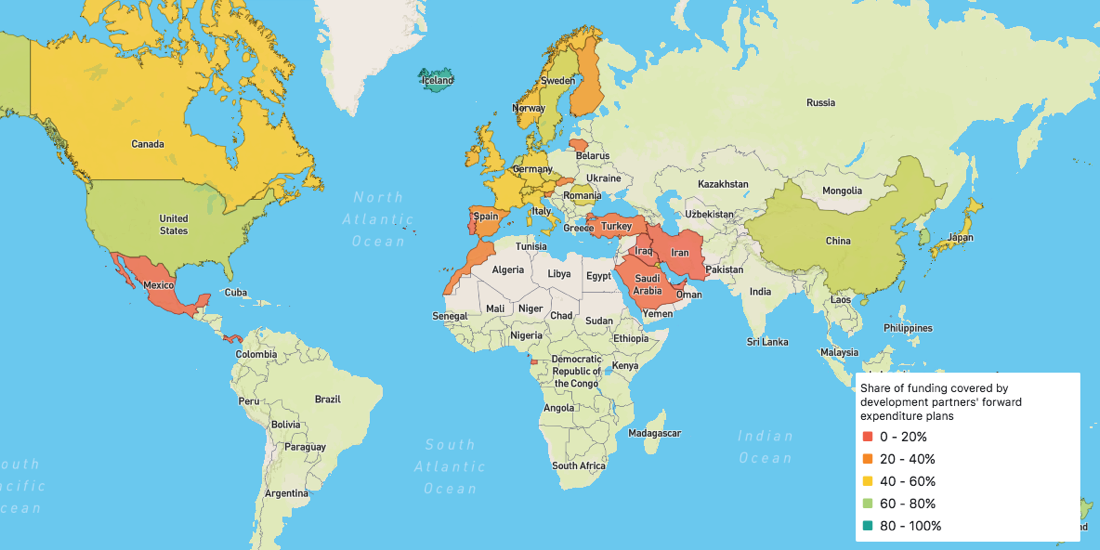
Map of the Month: Global Partnership for Effective Development Co-operation Dashboard
Officially launched in March 2018, the Global Partnership's Dashboard is specifically designed to be the monitoring tool that Partner Countries need to measure their progress

Map of the Month: Displacement Alert Map 2.0
Created using CARTO.js and pulling in open data from multiple sources, DAP Map will help in the fight against housing displacement.

Map of the Month: City Health Dashboard
Using the City Health Dashboard, city leaders are empowered by local data, and the tools to visualize and analyze that data to improve citizen health in 500 American cities

Location Intelligence: The End of GIS As We Know It
GIS set the foundation for businesses to begin collecting and visualizing geographic information. But in order to stay competitive, businesses know they need to focus on the intelligence from their location data, not just on the geographic information itself.

