Of The Most Clicked Location Intelligence Stories of 2018
Sharing 20 of the most clicked articles from the CARTO 5, CARTO's weekly Location Intelligence industry newsletter

Modernizing Catchment Areas With Human Mobility Data
While common methods like isochrones help businesses understand where their customers could come from, Catchments made with human mobility data help businesses see where there customers really are coming and going.

Mobile Data 101: 15 Questions to Answer Using Mobile Data
Mobile Data is a powerful tool for answering a wide array of complex business questions

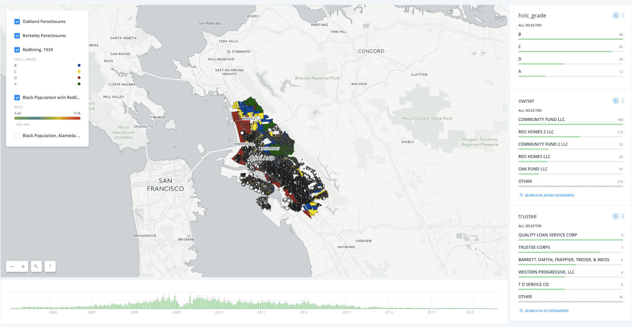
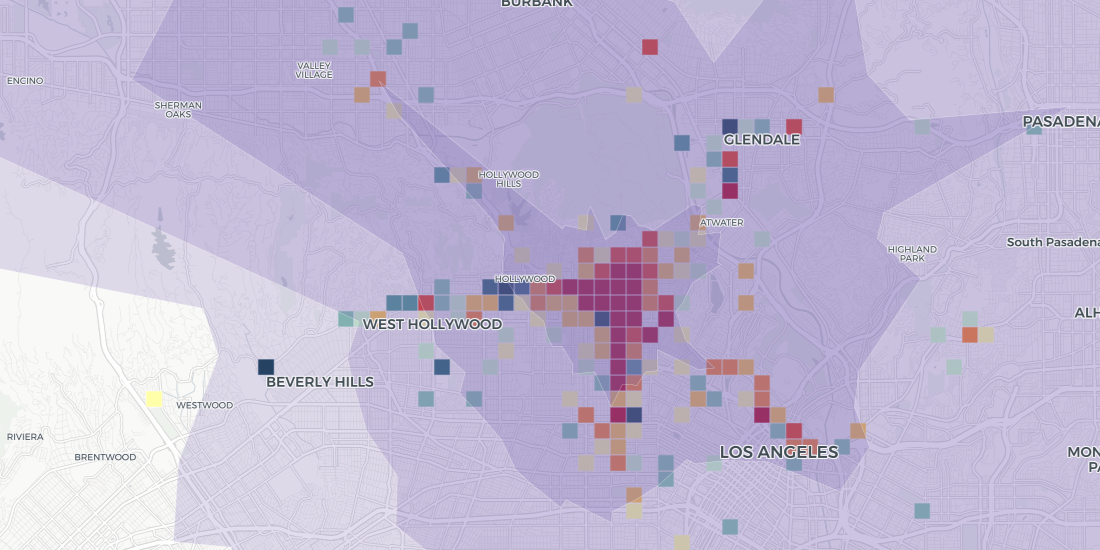
Meet the growing demand for senior care facilities with a modern site planning approach
Discover why healthcare professionals are turning to location intelligence when deciding when, where, and in what form to open senior care centers to meet medical needs of rapidly increasing senior population.

Measuring the Potential Impact of Amazon HQ2 on DC and Other Candidate Sites
Using Location Intelligence to show how modern site planning can shine a light on the impact of Amazon’s forthcoming HQ2 on local communities, the private sector, and Amazon itself

Mark your calendars for CARTO’s Spatial Data Science Conference 2018
Learn what’s in store during our Spatial Data Science Conference on Friday, October 12th

Mapping the Impact of Madrid's Line 5 Shutdown
Find out how Location Intelligence help local officials measure impact transit closures will have upon cities in our latest post.


